
We simplify your service to farmers.
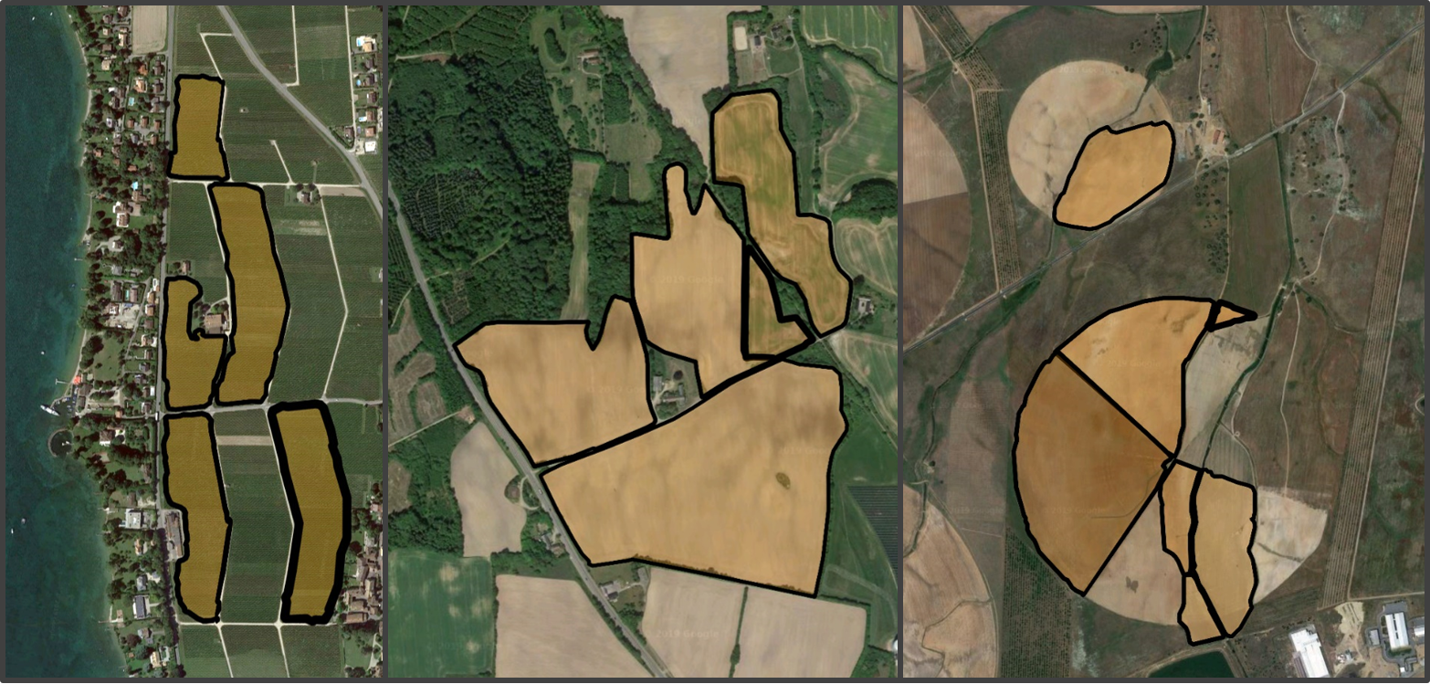
Geometric Field Boundaries are the foundation of any field-level digital farming application.
Spacenus uses Artificial Intelligence to automatically detect and monitor the cropped area in agricultural fields.
Our service is available as API and can be integrated in any digital farming application.

Get your customers onboarded easier
Field analysis or application map – you first need your customer’s field to perform your service. While drawing tools and upload features are cumbersome, with our API your customer adds new fields in seconds.

Free yourself from the jungle of geo file formats
Stop wondering in which format your customer could upload his field geometries to your system. Our Field Boundary API provides you the geometric information in a geoJSON fomat. Always.

Accurate Boundaries
Field machines or flying drone - the geometry of a field boundary needs to be accurate to be useful. We provide an accurate solution for automatically detected field boundaries.
Unlocking new user experiences
You can integrate our service in your app to support your users starting with your service. Adding fields in the on-boarding process gets done with just one click on a map.
Drawing Field Boundaries on maps is either complicated or inaccurate. Make it easier for your users by integrating our service as the data source for boundaries.
We offer a trial version of the Field Boundary API with no commitments.
Service
Field boundaries are the foundation of any digital farming application. Our service is unique and accurate.

Pricing
Our Field Boundary service is provided as API. Have a look on the different subscriptions.

About
We combine Artificial Intelligence with aerospace technology and image recognition.